Members only
This project, the SARS-Yale Atbai Survey, is a new archaeological reconnaissance and survey of the Eastern Desert of Sudan. The mission surveyed key goldmining sites and nomadic camps that have undergone little to no investigation, but have been identified from previous surveys, archival material, and/or satellite photography. The Eastern Desert of Sudan is well-known as a gold rich area and there are vestiges of mining operations in almost every period from the Second Millennium BCE until the Arab Period. Goldmines are found in almost every region of this vast desert. Major mining nodes are known in the Allaqi, Onib, and Oshib regions as well as a vast desert north and east of Abu Hamed, a region that may have perhaps been called Amu in New Kingdom Egyptian texts. Goldmining continues to the present day, and much of the desert is at threat from modern mining activities which quickly erase any vestiges of the ancient past. A key aspect of this survey is documenting the ancient remains of the desert so that we may have a record of the desert’s ancient past.
Remains of mining activity were documented in the vast surveys of Rosemarie and Dietrich Klemm as well as several expeditions conducted by Alfredo and Angelo Castiglioni, but there has been very little follow up work at these key sites to ascertain definite details about their occupation. The desert is also littered with nomadic camps, belonging to ancient nomadic groups of groups such as the Medjay, Blemmyes, and Beja. The goal of the continuing survey is to ascertain the level of preservation at key mining sites and nomadic camps, as will identify the cultural affiliation and date of mining sites while also prospecting the region for new inscriptions and rock art sites. This project has its genesis as part of Julien Cooper’s work in the Nomadic Empires Project, an interdisciplinary project investigating nomadic groups in World History.
A Blemmyean and early Arab goldmine deep in the Eastern Desert at Alitiatib. This is the intended focus of the next season.
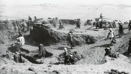
One of the aims of the season was a survey of the goldmine at Alitiatib in the midst of the Wadi Amur, deep in the Red Sea Hills. One of the interesting and salient features of the site was the large quantity of Eastern Desert Ware found at the site – a hallmark of the local Blemmyean desert nomads. The quantities of this ware strongly point to the control of this goldmine and settlement by this indigenous nomadic group rather than foreign Nubians or Egyptians. The settlement, situated in the fertile Wadi Amur, also likely functioned as a way-station between the Red Sea and the Nile, as is indicated by the finds of sea shells. Such a site challenges the common view that mining in the desert was dictated by foreign concerns, rather than an enterprise of indigenous nomads. The survey, following the Wadi Amur towards the Nile, identified a new cemetery of ring-graves at the hill of Di’irabab. The cemetery is on the crest of a small hill. The lack of surface deposits around the tombs makes the site difficult to date at present.
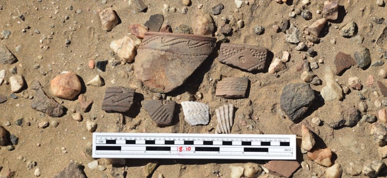
Finds of Eastern Desert Ware along with Red Sea Shells.
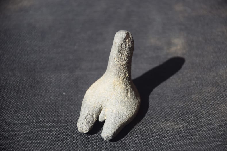
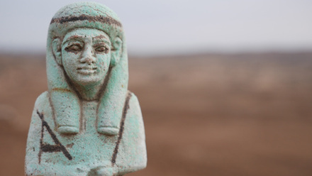
Fertility figurines found at the south cemetery of Alitiatib of likely Late Antique date (c. 300-800 CE)
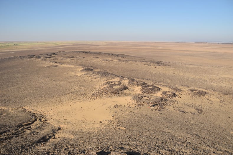
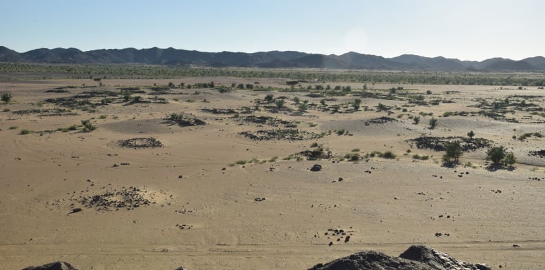
A new cemetery of 'ring-graves' found at Gebel Di'irabab.
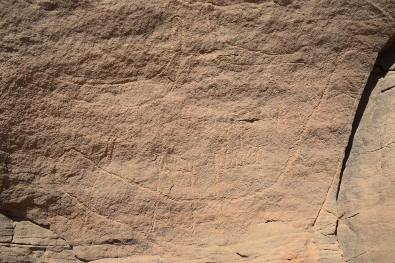
After the Wadi Amur, the survey continued into the deserts east of Lower Nubia. Two new rock art sites were discovered in the deserts east of the Second Cataract, site 18.25 and 18.27. Site 18.25 “Gebel al-Sayd” (Mountain of the Hunt) was a large cave or overhang in an inselberg, with rock art mainly of a faunal nature (cattle, giraffes), but also including a depiction of a hunt and several other enigmatic depictions that require further investigation. Site 18.27 “Gebel Maraekib” (Mountain of the Boats), an inselberg that looked over the main valley leading east of the Second Cataract, contained a large scene depicting a fleet of boats dating to late Naqada II or early Naqada III. This site had the appearance of a lookout post, situated on a prominent inselberg that afforded a good vantage of the routes leading east and west.
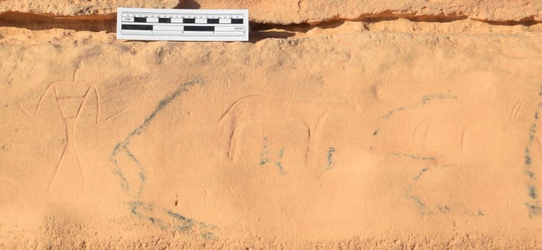
A newly discovered rock-art relief depicting a hunt, with modern Arabic graffiti (site 18.25)
A newly discovered boat tableaux, dating to late Naqada II or early Naqada III (site 18.27)
The first season of the Atbai survey shows the great potential for future fieldwork in the desert. Future surveys will continue the task of surveying the region, all the while documenting the threatened heritage of this desert. The challenges of working in this desert are manifold. There are very few villages containing requisite supplies of food and fuel, desert tracks are frequently washed out or non-existent, and vehicular navigation between the jagged hills of the Red Sea is extremely challenging. With a good team, however, these challenges just make the archaeology and the discoveries all the more rewarding!
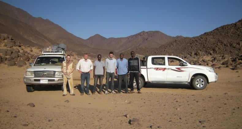
The 2018 SARS-Yale team, Pierre Meyrat, Vivian Davies, Hozaifa Abdelmagid, Julien Cooper, Osman Dafalla, Mubarak Adam.
The mission thanks NCAM, Drs Abdelrahman Ali, El-Hassan Ahmed, Mahmoud Soliman, and Hozaifa Abdelmagid for making the 2018 season possible and for their co-operation and help in difficult desert conditions. The expedition was funded by the Gerald Avery Wainwright Fund (Oxford University), The Egypt Exploration Society, and William K. & Marilyn M. Simpson endowment (Yale University). The project was also indebted to the logistical support of the Sudan Archaeological Research Society.
This project is a new archaeological reconnaissance and survey of the Eastern Desert of Sudan. The mission will survey key goldmining sites and nomadic camps that have undergone little to no investigation, but have been identified from previous surveys, archival material, and/or satellite photography. This survey project will ascertain the level of preservation at key mining sites and nomadic camps, as will identify the cultural affiliation and date of mining sites while also prospecting the region for new inscriptions and rock art sites. The eventual goal is to gain a much better understanding of the chronology of nomadic settlement in the region and also gain an appreciation of the relationship between Nile states (Nubia, Egypt) and the indigenous nomads.
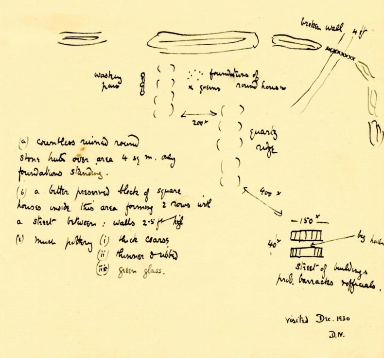
Sketch map of an ancient mine in the Eastern Desert, from the archive of Douglas Newbold, © Griffith Institute, Oxford
The desert contains the remains of two different groups, the expeditionary ventures of Nile regimes in Egypt and Sudan (Kerma-Kush, Napata, Meroe) and the remains of the indigenous inhabitants, the nomads. A key question for the archaeology and history of the desert is how these two disparate groups interacted, especially in the backdrop of goldmining and resource exploitation. For the agricultural kingdoms on the Nile in Egypt and Nubia, the desert was a source of exotic materials, notably gold but also aromatics and exotic fauna as well as other minerals like malachite. For the local nomadic groups, the desert was their homeland, a vast space which they roamed in search of pasture and water sources for their herds. The question of just who was engaged in mining operations in various periods, and the measure and intensity of state control in mining sites has not been assessed. This is one of the key issues relating to the history of the desert and will address the nature of foreign imperialism in the nomad heartland. Many un-surveyed goldmines, nomad camps (chiefly dry-stone wall huts) and associated cemeteries, rock art, and inscriptions can be found in this vast desert region.
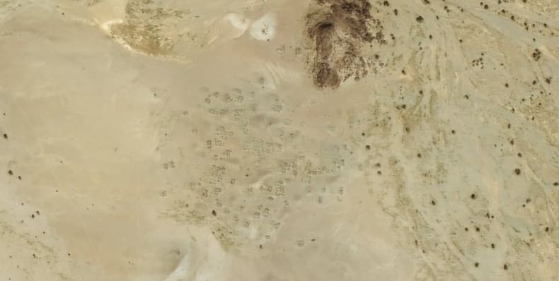
An 'enigmatic' Late Antique nomadic camp in the Eastern Desert? Such camps with dry-stone walls are relatively common features in the deserts east of the Fourth and Fifth Cataracts. © DigitalGlobe 2014.
One of the key foci of this project is investigation of the large nomadic camps which are encountered in the desert of Eastern Sudan. These bear a similarity to the so-called ‘enigmatic sites’ found in the Eastern Desert of Egypt, sites which likely belong to the nomadic Blemmyean groups who reached as far north as the deserts of Coptos. Initial investigations of these sites reveal that many of them contain Eastern Desert Ware, a decorated ceramic type that is often connected with the Blemmyes of Late Antiquity and is also known from some ‘enigmatic sites’ further north in the deserts east of Upper Egypt. Documentation of these sites will add new knowledge to the history of this often forgotten desert, and fill in the map to reveal the heartland of the Blemmyes.
Barnard H. 2008. Eastern Desert Ware: traces of the inhabitants of the eastern deserts in Egypt and Sudan during the 4th-6th centuries CE. (Oxford).
Castiglioni, A., Castiglioni, A. & Vercoutter, J. 1995. Das Goldland der Pharaonen (Mainz).
Davies, W. V. 2014. ‘The Korosko Road Project: recording Egyptian inscriptions in the Eastern Desert and elsewhere’, Sudan & Nubia 18, 30-44.
Klemm, R. & Klemm, D. 2013. Gold and Goldmining in Ancient Egypt and Nubia (New York).