Members only
Last November and December 2018 a survey has been carried out at Kafr el-Dawar province in the western Delta. The regional survey has been achieved in the framework of the Delta Survey Project of the Egypt Exploration Society with logistical support from Durham University and it was financially supported by the British Academy through the Egypt Exploration Society and by Marie Sk?odowska-Curie Actions.
The survey focused its investigation on four selected sites nearby the town of Kafr el-Dawar, in the Beheira province. The sites we surveyed were Kom el-Ghasuli, Abdu Pasha; Kom el-Magair, today split into three different sites, I, II and III, and the site of Kom el-Mahar.
The survey aimed to create a detailed dataset for those places for which information is still lacking, or it is not widely available or where we spotted possible interesting ancient sites.
Other goals were to add a photographic record and provide information to improve the database of the sites in the Beheira region for further studies and excavations, for monitoring the current preservation of selected areas and for integrating and comparing our data with other published or unpublished sources.
Each site presented unique elements and it wasn’t always possible to use the same methodology and the same level of investigation for all of them. The activities we carried out were mainly:
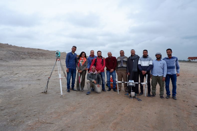
The survey team in 2018
(Beheira governorate. EES Delta Survey No. 362 -31° 05’ 51N’’ 30° 08’ 25E’’-)
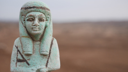
Kom el-Ghasuli is located close to the modern village of Al-Baslaqun, nowadays surrounded by fields. The site was already included in the 1916 Survey Maps of Egypt, where it appears with the name of “Ghaswleh”. However, it does not appear in the 1992 Topographical Map of Egypt. Giuseppe Botti visited the site for the first time in 1902 and he recorded figurines, Byzantine coins of Costantine I and poor quality pottery.
In addition, the site was surveyed by Dr Kenawi in 2008. Kom el-Ghasuli was very close to the site of Kom el-Qadi and Abdu Pasha. It was likely that these three sites were originally part of one larger site with different settlement areas, and the study of surface pottery seems to confirm this assumption.
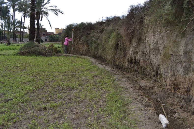
The remaining site presents an irregular shape, characterised today by two sandy mounds of which the highest mound is 2.14 m above the field level. The northern area of the kom has been levelled in two flat areas. The mound and the flat area itself is has a surface of loose, dusty soil with a medium density covering of pottery. There is no archaeological material visible on the surface, but sections at the side of the kom show clear stratified sequences of layers, including brick and pottery deposits. The surface pottery indicates an occupation range from the 2nd century BC to the 7th century AD and there was a high presence of imported amphorae (LRA1 and LRA 4) and table wares coming from Cyprus, Levant, and Asia Minor. The presence of AE 3 and its late editions is clearly attested.
View of the northern, levelled area of Kom el Ghasuli
Kom el-Ghasuli, eastern side of the tell
(Beheira governorate. EES Delta Survey No. 621 -31° 04’ 47’’N 30° 09’ 17’’E-)
It appears in the 1916 Survey Maps of Egypt with a larger dimension. Abdu Pasha has been levelled for reclamation of agricultural land over time and nowadays only a small part of the tell is preserved, surrounded by irrigation ditches and fields and partially overbuilt by the modern village of Ezbet Abdu Pasha. From the Corona satellite image, we can see that the site in 1968 was slightly larger but already levelled.
The surface of the mound consists of loose compact soil and no clear structures and material are visible on the surface of the mound and around the flat areas. The pottery from this site was collected mainly from the fields around the small tell and from a section cut at the middle of the site. The surface pottery shows a high percentage of material of local production, such as Egyptian amphorae and vessel stands, dated mainly to the Early and Late Ptolemaic Period. It too was probably part of the supply chain between the lake and the Canopic Nile branch.
(I, Beheira governorate. EES Delta Survey No. 395 -31° 02’ 19’’N 30° 07’ 46’’E-), (II Beheira governorate. EES Delta Survey 697 31° 2'7.84"N 30° 8'42.28"E), and (III Beheira governorate. EES Delta Survey No. 698 -31° 02’ 12’’N 30° 08’ 19’’E-)
Kom el-Magayir I, II and III were originally part of one settlement but are nowadays separated by a modern road and the Shereishra canal, partially overbuilt by the modern villages of Baba el-Koupra (Kom el Magayir I ) and el-Hilbawi and by a modern cemetery (Kom el-Magayir III). Kom el Magair I already appear in the 1916 Survey Maps of Egypt. The sites may have lain along a waterway extending into the ancient lake, as their linear arrangement suggests. The pottery recorded in this area includes local and imported amphorae coming from the eastern Mediterranean and a high quantity of table wares produced locally. It dates from the early Ptolemaic to the Late Roman Period, confirming a connection with Kom Magayr I. During a brief visit at Kom el-Magayir I we noted that several brick structures are still visible on the surface below the modern village. Kom el-Magayir II presents numerous firebricks scattered across the site showing a variety of building features still visible on the surface, but nowadays collapsed. It does not appear in the 1916 Survey Maps and neither in the 1992 Topographical Map. Only a couple of diagnostic pottery sherds were collected in this area. it is hard to pinpoint any date of a human activity of this place based on few pottery sherds we recorded, as well as it is not possible to determine the exact identification of the structures and its relation with Kom el Magair I. In addition, doubts may also arise concerning the identification of the area as an archaeological site, since the Corona satellite image shows modern buildings in that area in 1968
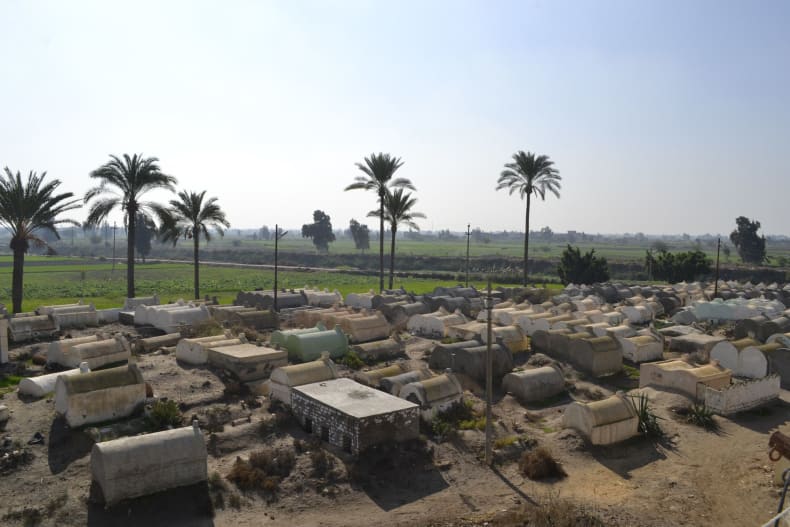
View of the mound of Kom el Magayir III, overbuilt by a modern cemetery with the modern road and the Shereishra drainage canal in the background
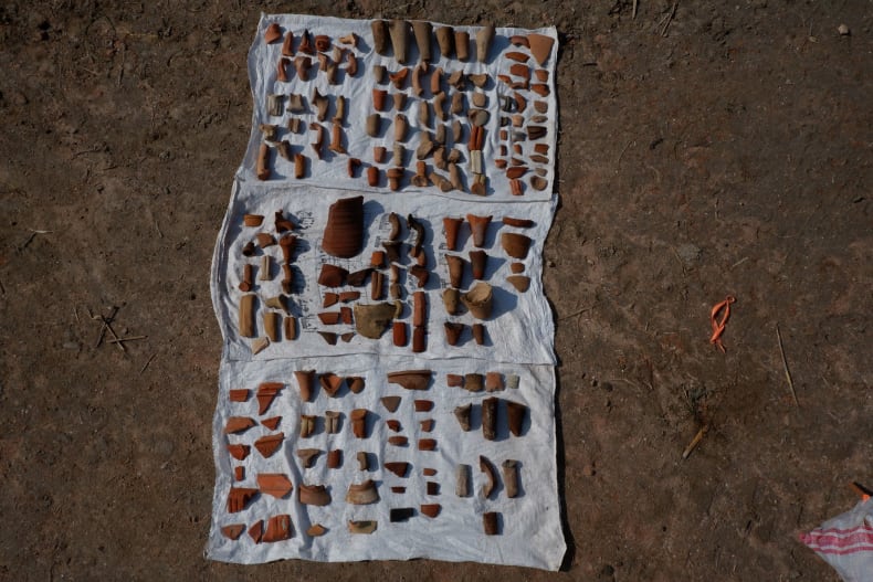
Pottery collected at Kom el Magayir III
(Beheira governorate. EES Delta Survey No. 398 -31° 01’ 22’’N 30° 03’ 34’’E-)
Nowadays, the site is surrounded by fields and irrigation ditches, and its eastern part has a modern cemetery which is gradually extending towards the west side, on the top of the mound. The meaning of the name of the kom is “Mound of shells” and this name is due to the fact that the surface of the site is covered in many shells. They may have come from the nearby Lake Mareotis in antiquity, when mud from the lake was used to make bricks. The analysis of the pottery carried out by Dr Wilson in 2004 and Dr Kenawi in 2009 in previous surveys indicates that the site was a Ptolemaic foundation, and it was abandoned around the time of the Arab invasion (seventh century AD).
A geophysical survey has been proven to be particularly effective in reconstructing the layout of settlement of this site. Indeed, the magnetic map shows that there were clear structures with rectangular plans and of different sizes on the eastern side of the flat area and on the top of the mound.