Introduction
A British Academy Research Project
The Delta Survey has operated by the Egypt Exploration Society since 1997 and was accepted as a British Academy Research Project in 2007. Its purpose was to assess the current condition of the lesser-known archaeological sites of Lower Egypt by conducting on-site assessments enhanced by mapping surveys, geophysical work and selective excavation. The results of these surveys have been combined with information from published and unpublished sources to create an extensive dataset for the archaeology of Lower Egypt. This is now available in the volume by Jeffrey Spencer, The Archaeological Sites of Lower Egypt: A Gazetteer. EES Excavation Memoir 119, 2024, containing all results down to early 2024.
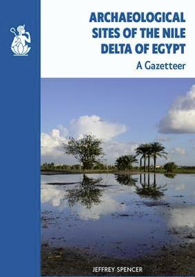
Archaeological Sites of the Nile Delta of Egypt
“This book is a remarkable achievement and extremely important for Delta archaeology and history!”
Dr Robert Schiestl
“This comprehensive publication … is sure to become an essential reference for archaeological research of sites and settlement patterns in Lower Egypt for decades to come.”
Dr Hannah Pethen
Archaeological Sites of the Nile Delta of Egypt is a directory, making available the data on all 783 of the sites in the Egypt Exploration Society's Delta Survey. Data has been gathered from bibliographic sources, dedicated fieldwork and information from Egyptian and foreign missions in order to present a body of material previously available only in summary online. The book provides all the information in enhanced and extended form, with descriptions of each site, noting especially changes in condition over time, previous discoveries and current fieldwork, together with key references to bibliographic or other sources. This is an essential index of the ancient settlements of the Delta, alerting archaeologists and historians to the large cities, small towns, fortress and temple sites that covered the Delta in antiquity. The volume presents the results of a research project extending over four decades on the identification, location and character of the archaeological sites of Lower Egypt. The project has been known since 1997 as the Egypt Exploration Society's Delta Survey (supported by the British Academy).
You may also be interested to visit the separate Western Delta Regional Survey on Durham University's website here: http://community.dur.ac.uk/penelope.wilson/Delta/Survey.html
Delta Reports
Delta Reports is a journal dedicated to the publication of archaeology, geography, history and heritage relevant to the Nile Delta. The first volume Delta Reports 1 Research in Lower Egypt was published in 2009 and edited by Donald Redford. The series has been restarted with a full editorial board and will be published by Archaeopress. Each edition will be published when a sufficient number of papers have been prepared, so there is a rolling deadline.
The publication aims to make fieldwork reports from the North of Egypt (including Alexandria, Wadi Tumilat, Wadi Natrun and North Sinai) available soon after the fieldwork has been completed. Each volume would contain about 10-15 reports from fieldwork, in order to make the material immediately accessible to other archaeologists and interested parties. There is no limit on time-period and historical and heritage material will also be accepted. The volumes will be edited by the editorial board and another academic reviewer. Reports would be published in English or Arabic and all reports would have an English/Arabic abstract.
If you are interested in sending us a paper, please do contact the email address below.
All correspondence and submissions should be made to: [email protected]
About
Development of the Delta Survey
The original core of the Delta Survey information was collected by Jeffrey Spencer over many years, later supplemented with contributions from others, acknowledged below. Research on the Delta was promoted by the call for action by the Congress of Egyptology in 1979, where the risks to the archaeology of the region were noted. The Delta was the focus of the earliest work of the Egypt Exploration Fund, so it is fitting that it should return there. The sources for the survey began with maps, including the early Arab map of Al-Maqrizi, those published by the Déscription de L'Egypte and numerous editions of maps produced at various scales by the Egyptian Government Survey of Egypt. New maps of the Delta were produced by the Egyptian Government Survey Authority in 1996 at a scale of 1:50,000, although the actual surveying was done in 1992-3. They have value in showing the changes brought about through development, particularly many new asphalt roads, although these maps are also now well out of date. Sites are indicated as white areas, but not named so consistently as on older Survey of Egypt maps. After study of the maps, the bibliography of Delta sites was researched for all relevant information, noting particularly the reports on inspections of sites for the Service des Antiquités by Foucart, Daressy and Edgar.
Since the EES survey was initiated, the Egyptian Government established the Egyptian Antiquities Information System (EAIS) for site documentation. At present, their data is focused on site locations and property boundaries, but archaeological information is being added. The EES survey has shared its data with the EAIS. The first major publication of the EAIS, edited by Neguib Amin, The Historical Sites of Egypt, Volume 1, Ash-Sharqiyyah Governorate, appeared in 2006. The SCA has also produced through CultNat a set of four colour brochures for the Delta with site reference numbers and rough maps.
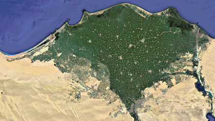
All the data collected from published sources has been supplemented by fieldwork, ranging from visits to record the present condition and character of sites in the region to full mapping surveys or geophysical investigation. On the basis of these, a few sites were chosen for limited excavation. The increasing availability of high-resolution satellite photography has provided another valuable tool, easily accessible through Google Earth©. The addition of an option to view not only the most recent images but also historic ones is most valuable for the Survey, allowing the changing condition (usually progressive disappearance) of archaeological sites to be monitored. Another valuable resource for information on the former condition of sites is the imagery from the U.S CORONA programme of the 1960s, now owned by the U.S. Geological Survey and made available by the Center for Advanced Spatial Technologies, University of Arkansas, in the Corona Atlas of the Middle East.
Conference
Delta Survey Conference
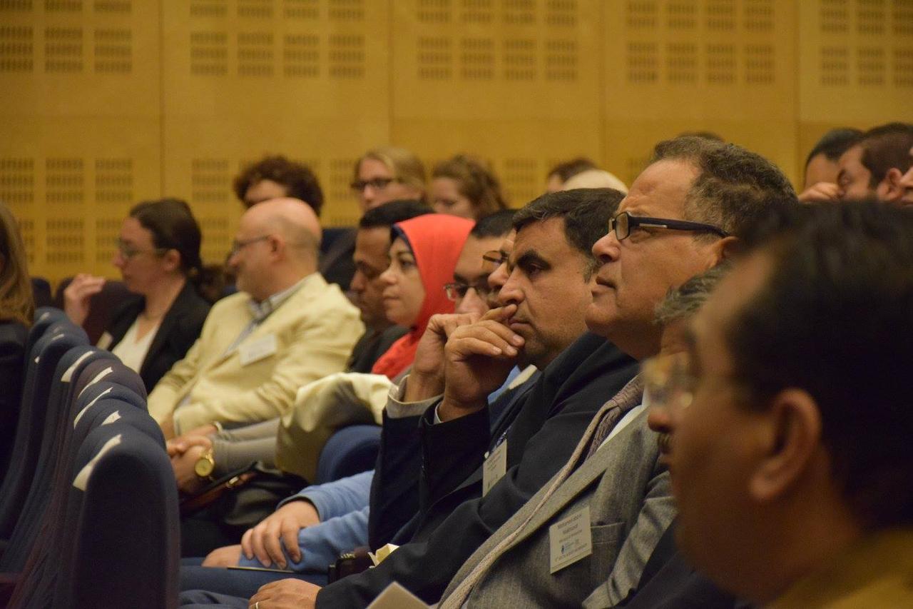
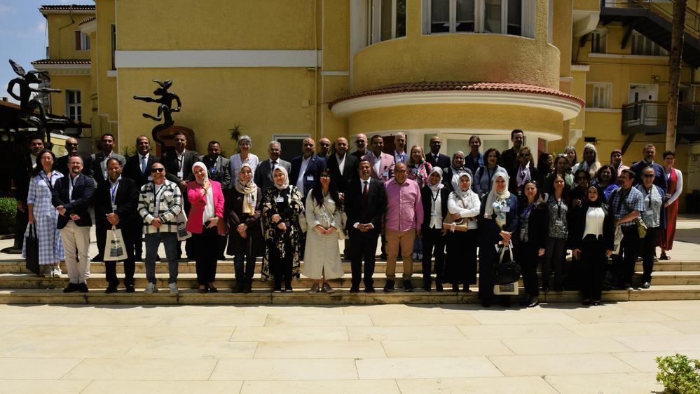
Delegates attending the fifth Delta Survey Workshop at the Bibliotheca Alexandrina in 2017
The Delta Survey Conference is a biannual event bringing together researchers working in the Egyptian Delta. It is supported by the EES Delta Survey project and run in collaboration with a host institution and always in partnership with the Ministry of Tourism and Antiquities.
Next Conference
The 10th Delta Survey Conference will be held in 2027, as a collaboration between the Egypt Exploration Society and the Ministry of Tourism and Antiquities. It will mark the 30th anniversary of the EES adopting the Delta Survey project.
We are grateful for the support and collaboration of the Ministry of Tourism and Antiquities and the British Academy through the Delta Survey Special Project of the Egypt Exploration Society for supporting the Conference and Workshops.
Previous events
The first Delta Survey Workshop was held on 26 March 2009 at the British Council in Cairo. Click here to read a report on the papers given and the lively discussions which ensued.
Following the success of the first Workshop in Cairo a second was arranged for 2011, this time lasting two days (31 March - 1 April). Read the programme and abstracts here.
A Delta Survey Study-Day was held on 19 November 2011 in Berlin and a trip for EES members was organised to coincide with it.
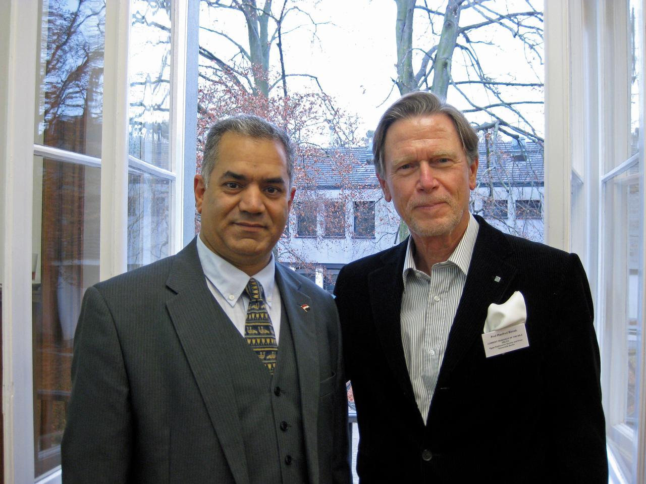
Professor Dr Mamdouh Eldamaty with Professor Manfred Bietak at the Delta Survey study day held in Berlin in 2011.
On 22-23 March 2013 the third Delta Survey Workshop was held in Cairo and, following several requests for the papers to be made available, it was agreed that participants should be invited to send material which would be prepared for publication and uploaded online. Click here to read more about the research presented.
The fourth Workshop was held in Cairo in March 2015.
On 6 June 2015, the EES held a Delta Discoveries seminar event in London brining together its own archaeological projects in the Delta to discuss their latest work and collaborations.
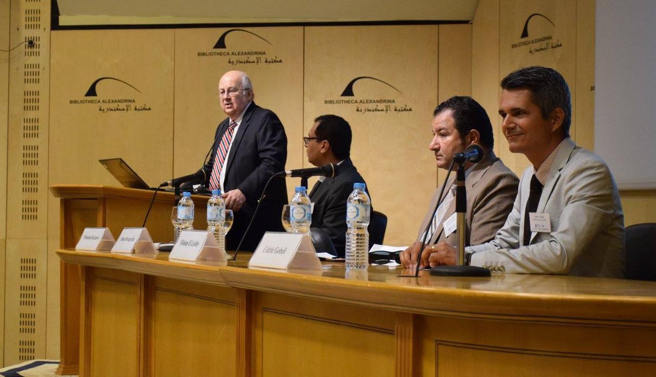
The fifth Delta Survey Workshop was held on 6-7 April 2017 at the Bibliotheca Alexandrina. For two full days, more than 150 scholars gathered to discuss the most recent archaeological discoveries in this region of Egypt. Read more about this Workshop here.
The Director of the Bibliotheca Alexandrina, Prof Ismail Serageldin, opens the 5th Delta Survey Workshop. Next to him (L-R) are Dr Mohamed Kenawi, Director of the Centre for Hellenic Studies in the Bibliotheca Alexandrina, Dr Hisham el-Leithy, Director of the Documentation Centre Ministry of Antiquities, and Dr Cédric Gobeil, Director of the Egypt Exploration Society.
In 2019, the sixth Delta Survey Workshop was hosted by the University of Mansoura on 11-13 April.
The seventh Delta Survey Conference and Workshop was held on 30th September and 1st October 2021 on Zoom during the global pandemic. This year, the event focused on work conducted in the Delta between 2019 and 2021.
The eighth Delta Survey Conference and Workshop was hosted by Ain Shams University, Cairo on 18th-20th March 2023.
The ninth Delta Survey Conference was held at the British Council in Cairo from 10th-12th April 2025, as a collaboration between the Egypt Exploration Society and the Ministry of Tourism and Antiquities.32 projects presented their latest work to almost 200 attendees online and in-person. Seven posters were also submitted and displayed during the conference.
Delta Survey Online
Delta Survey Online
Welcome to the Delta Survey Online, an interactive map allowing you to explore the archaeological sites of the Nile Delta.
The data presented here has been compiled by the EES Delta Survey since 1997 and includes almost 800 archaeological sites in Lower Egypt. Further data has been contributed by other research projects and we’re grateful to them for their collaboration.
The survey of the Nile Delta has only been made possible thanks to our ongoing partnership with the Ministry of Tourism and Antiquities, and the generous support of the British Academy.
The map has been created by Dr Hannah Pethen using ArcGIS. We would like to acknowledge the support and guidance of ESRI and their non-profit team.
How to use the map in Map Viewer
You can explore the map above, but for more detail you should use Esri's Map Viewer. Open the map in Map Viewer (click the top icon on the bottom right-hand corner of the map), then use your mouse to pan across the Delta clicking on each site to find out more information. Zoom in to see the sites in greater detail on the satellite image.
You can filter the sites you would like to explore by using the ‘filter’ function on the right-hand side of the screen. Here you can search for specific sites, filter by period, or reference. Use the % sign as a wildcard to broaden your criteria.
If you would like to turn off some layers (such as the modern governorates, for example) then use the layers tab on the left-hand menu and unselect the layer you wish to hide.
You will find references within the entries to Archaeological Sites of the Nile Delta of Egypt: A Gazetteer by Jeffrey Spencer (2024). You can download the bibliography from this publication here to help find further resources.
Terms of use
The information available on the map is freely accessible to all. However, if you wish to reproduce any of the information or embed the map in your own website, then please follow our usual process to request permission.
We suggest that you reference the map as:
EES Delta Survey, Delta Survey Online, the Egypt Exploration Society: https://www.ees.ac.uk/our-cause/research/delta-survey.html [last accessed XXXX].
If you have a research project that you wish to carry out using the data available in this map, then please contact us.
Wish to contribute?
If you have data that you would like to contribute to the mapping project or spot an error, then please contact us by providing the relevant information via one of our forms available below. Please ensure that you include the name, governorate, and EES number (where applicable).
Explore the Nile Delta online
A series of story maps using the data presented in the Delta Survey Online are now available in our Digital Resources.